Google has unveiled its Geospatial Creator for Unity platform, allowing developers to preview 3D assets via the Unity Editor.
Viewing spatially-linked assets on a hyperrealistic 3D planet map, the toolkit powers ARCore and Photorealistic 3D Tiles via the Google Maps Platform, it said on its website.
Users can select locations, retrieve 3D geometry of the region, and navigate virtually-produced maps with flythroughs similar to Google Earth. Additionally, people can develop augmented reality (AR) experiences with the platform’s 3D viewing function.
The news comes as Google launches Photorealistic 3D Tiles as an Experimental version for use on its Map Tiles API. Using high-resolution optical imagery and 3D map sources, Google’s latest creation seamlessly builds 3D mesh models of real-world locations.
How Does Google’s Geospatial Creator for Unity Work?
Currently, Google’s Geospatial Creator for Unity offers visualisations of more than 2,500 cities in 49 nations. This comes with “comprehensive 3D geo datasets,” where users can select renderings and data overlays.
The platform leverages 3D tiles standards from Cesium’s Open Geospatial Consortium, allowing interoperable renderers and visualisation libraries.
According to the tech giant, gaming firms can develop real-world models for AR-based immersive experiences. Developers can also design AR experiences for physical locations via its Geospatial Creator.
Geospatial Creator leverages industry-leading platforms such as Google’s ARCore and Google Maps. Users can then integrate their creations via Unity and Adobe Aero Geospatial Pre-release.
Companies set to benefit from the creative platform include travellers using their smartphones to navigate spatially-anchored data in physical locations.
City planners and construction firms can also plan their future developments with bespoke immersive maps. Alternatively, news agencies can utilise the platform for 3D and 360-degree maps to enhance their stories.
Javier de la Torre, Founder and Chief Strategy Officer, CARTO, explained,
“Photorealistic 3D Tiles are a really exciting addition to Google Maps Platform. We can now create immersive 3D visualizations in the browser with the best 3D data available. Thanks to following the OGC 3D tiles specification, the integration with deck.gl and the CARTO ecosystem is very easy. Now our customers will be able to represent high-fidelity cities and terrain, and unlock use cases like line of sight and digital twins”
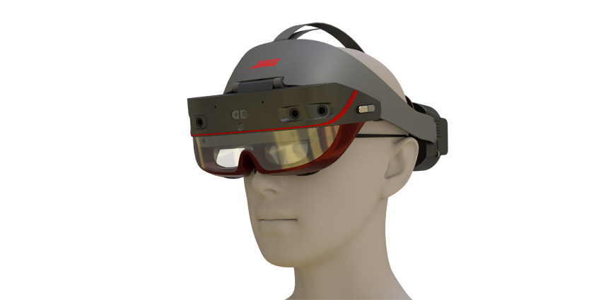
The comments come a year after Epic Games debuted a series of partnerships with NVIDIA, Microsoft, and Cesium. This led to Project Anywhere, a massive geospatial mapping and digital twins project for replicating global cities along with geospatial data.
Project Anywhere runs on the Microsoft HoloLens 2 headset while leveraging Cesium 3D Tiles datasets. Additionally, Unreal included its Pixel Streaming service for interoperability across devices.
ARway-Magic Leap-Microsoft Interoperability Measures
The news comes as global AR companies deepen cooperation to increase the number of interoperable enterprise solutions. ARway, a company specialising in immersive wayfinding technologies, partnered with Magic Leap and Microsoft to integrate its AR tools onto the latter’s cutting-edge headsets.
With the Magic Leap 2 and Microsoft HoloLens 2, ARway can leverage industry-leading hardware to integrate its low and no-code solutions. This will lead to developing ecosystems of products and use cases for potential clients.
Both headsets will offer massive hand and eye-tracking capabilities, spatial audio, and three and six degrees of flight (3DoF/ 6DoF). Firms can also build partnerships by implementing tools needed to incubate industry standards and interoperable ecosystems.
Furthermore, developers on Unity 2021.3 LTS can create with Unity’s backend support for HoloLens 2 and Windows-based mixed reality (MR) headsets.
Niantic Earth Day Initiatives
Similarly, AR firm Niantic has developed several critical use cases to measure the impact of its technologies on its social impact plans.
Using the firm’s geolocation software developer kits (SDKs), Niantic has created numerous sustainability programmes at UT Austin’s Texas Immersive Institute. For Earth Month, the company developed WebAR experiences “that solve real-world problems,” leading to immersive recycling initiatives.
With its RecyclAR application, users can scan items with their phones. Images are then analysed with artificial intelligence from Bing Reverse Image Search to determine if objects are recyclable.